Explore the Farm and top things to do
Discover the trails and tracks throughout the farmland or wander into the local townships for retail therapy and great coffee and wine trails.
When you check into Foxlow you will have access to our electronic guidebooks that show our top things to do and provide farm maps showing up to 50kms of marked trails that explore the Captains Flat Railway line, Foxlow Bridge and Shearing Shed, Snowy Woodlands, old ruins and more.
Book your e-bike and discover the bushranger history and landscape it has been famously know for. Camping available on property, pets welcomed.
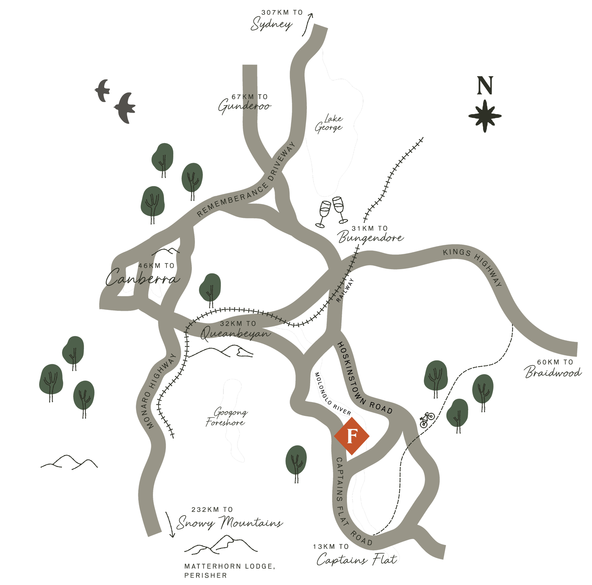
EXPLORE THE REGION
The historic townships of Bungendore and Braidwood are alive with antiques, fantastic food and wine trails. Enjoy Canberra’s world class galleries, exhibitions and top restaurants.
Find out everything you need to know about what’s on in the HerCanberra Guide - from must see exhibitions to the latest food and wine destinations.
-
The hotel offers casual counter meal dining and a full A La Carte restaurant. Counter meals are provided 7 days a week.
Promising good music, cold beer and good times, the Royal Hotel Bungendore offers wallet-friendly, old-fashioned pub fare alongside signature hospitality.
A cornerstone of the Bungendore community since 1885. Accommodation, Tavern, Restaurant, and Tearoom.
Just 40 minutes from Foxlow Grazing in Gundaroo is a dining escape like no other.
From live music on weekends to workshops for the young and old, there's always something happening at the Fyshwick Markets!
Upscale menu, including antipasti and handcut pasta, in a smart restaurant with a playful vibe.
-
Bungendore Fine Art exhibits and sells original paintings of both the seven gallery artists and also has a new artist on the wall every month or so.
The National Gallery is open every day 10am–5pm. Admission is free.
-
Manon + Moss supply architectural, outdoor and decorative products of the finest design and quality.
A unique retail collective in the beautiful country town of Bungendore NSW. Browse antiques, collectables and homewares.
Village Emporium and Boutique Nursery
Antiques, chinoiserie, garden follies, architectural oddities; and lots of other cool stuff.
-
Discover the landscape
Hire Mountain E-Bikes
Discover seven marked trails throughout Foxlow’s landscape leading to the Snowy Woodland Conservation Zone, Goose Meadow Ruins, Captains Flat Railway, Foxlow Bridge, and the Shearing Shed.
Grab a map from the Quarters and book the e-bikes to discover more of our iconic landscape.
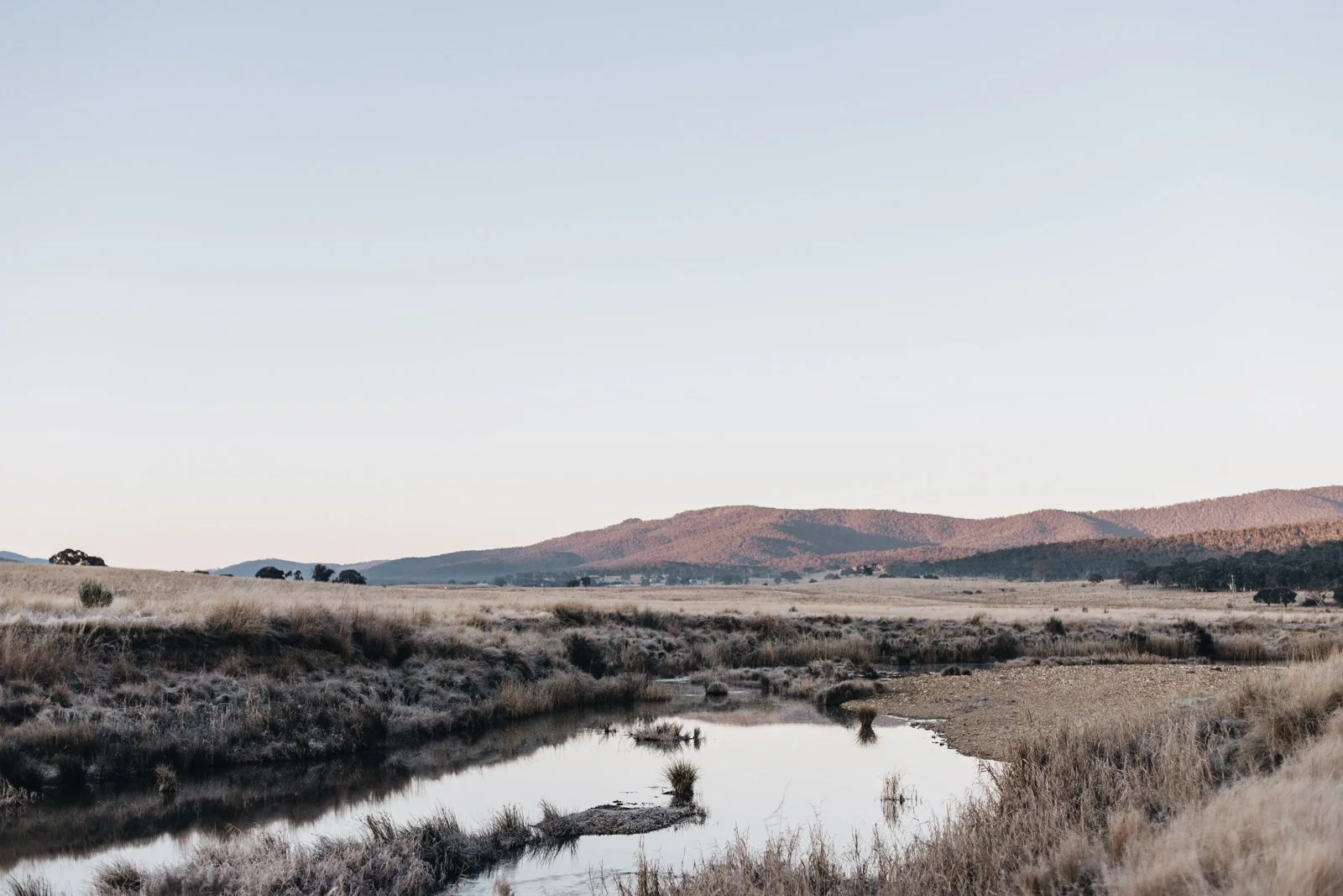
THE HISTORY of the MOLONGLO RIVER
The term Molonglo Plains refers collectively to the flood plains along the entire length of the Molonglo River, including the flood plain located north-east of Queanbeyan on the Molonglo River. The upper Molonglo Plain sometimes referred to as the Hoskinstown Plain is bordered by Foxlow, east by the low ridges of the Turallo Range, Forbes Creek Ridge and Thurralilly Hill before the steep rise up to the top of the Great Dividing Range.
The area is noted as the birthplace of cricketer and inventor of Australian rules football Tom Wills.
The Molonglo River is significant to Ngunnawal people because of its use as a pathway for Ngunnawal people travelling into the mountains for trade and ceremonial purposes. The waterways on Ngunnawal Country have sustained all life including their people and the plants and animals.
The word molongolo is derived from an Aboriginal word meaning “like the sound of thunder”.
The first white men to come to the area arrived around 1820, and began to settle along the Molonglo Plains, arriving at the junction of the Molonglo and Queanbeyan Rivers on 8th December 1820.
The Molonglo is part of Ngunnawal songlines and pathways throughout Ngunnawal Country. Songlines are the memory code that gives Ngunnawal people information from the landscape to tell the stories of vital knowledges, cultural values and wisdom.
The Molonglo River has a rich history of Ngunnawal occupation along its banks, with the river being a rich source of resources for food, fibre and tools.
As Traditional Custodians, the Ngunnawal people continue to feel a deep responsibility to preserve the spirit and stories of their ancestors throughout this landscape.


